Aerial imagery company saves money and time with INS/GNSS sensors
Aerial imagery company turns to Inertial Sense INS/GNSS navigation systems when looking to get accurate orientation information that helps them implement better automated data processing algorithms, requiring less human intervention.
To conduct an aerial survey, it is critical to obtain an accurate position estimate of the camera target. The Inertial Sense module is ideal for the camera and sensor orientation and geo-pointing.
Thanks to this photogrammetry application of the Inertial Sense module, our customers are able to collect accurate geomatics or other imagery in their aerial surveys.
About Customer: Ceres Imaging
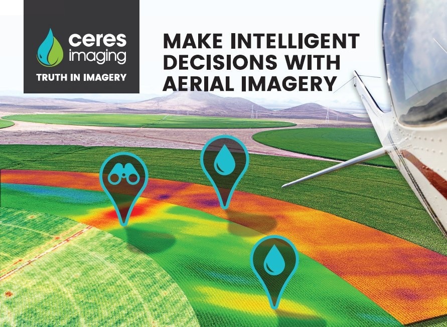
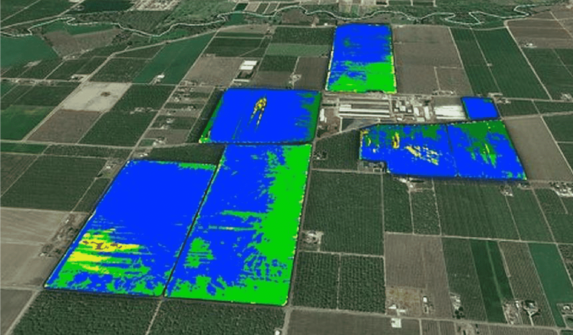
Ceres Imaging is an aerial imaging company that helps agriculturalists optimize their water and fertilizer application. Ceres takes multi-spectral aerial imagery of agriculture, processes it, then provides it to farmers as a service. This allows farmers to make timely farm management decisions at a very detailed level in order to save money on inputs, as well as spot problems with infrastructure. In order to collect the imagery, Ceres builds their own camera systems and fly them on small single-engine airplanes between 1,000 and 10,000 ft. above the fields.
Challenge
Choosing INS/GNSS to integrate into a high-performing aerial imagery sensor camera
Solution
Ceres Imaging selects Inertial Sense OEM INS module as their solution for aerial surveying and imagery
To start the development and integration, Ceres selected INS development kit. The INS fuses all sensor data in EKF and outputs attitude and position estimates. Upon the completion of the development and test flights, Ceres integrated our OEM solution which has a very small footprint, is low cost and maintains a tight accuracy.
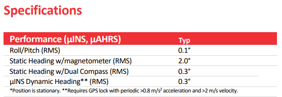
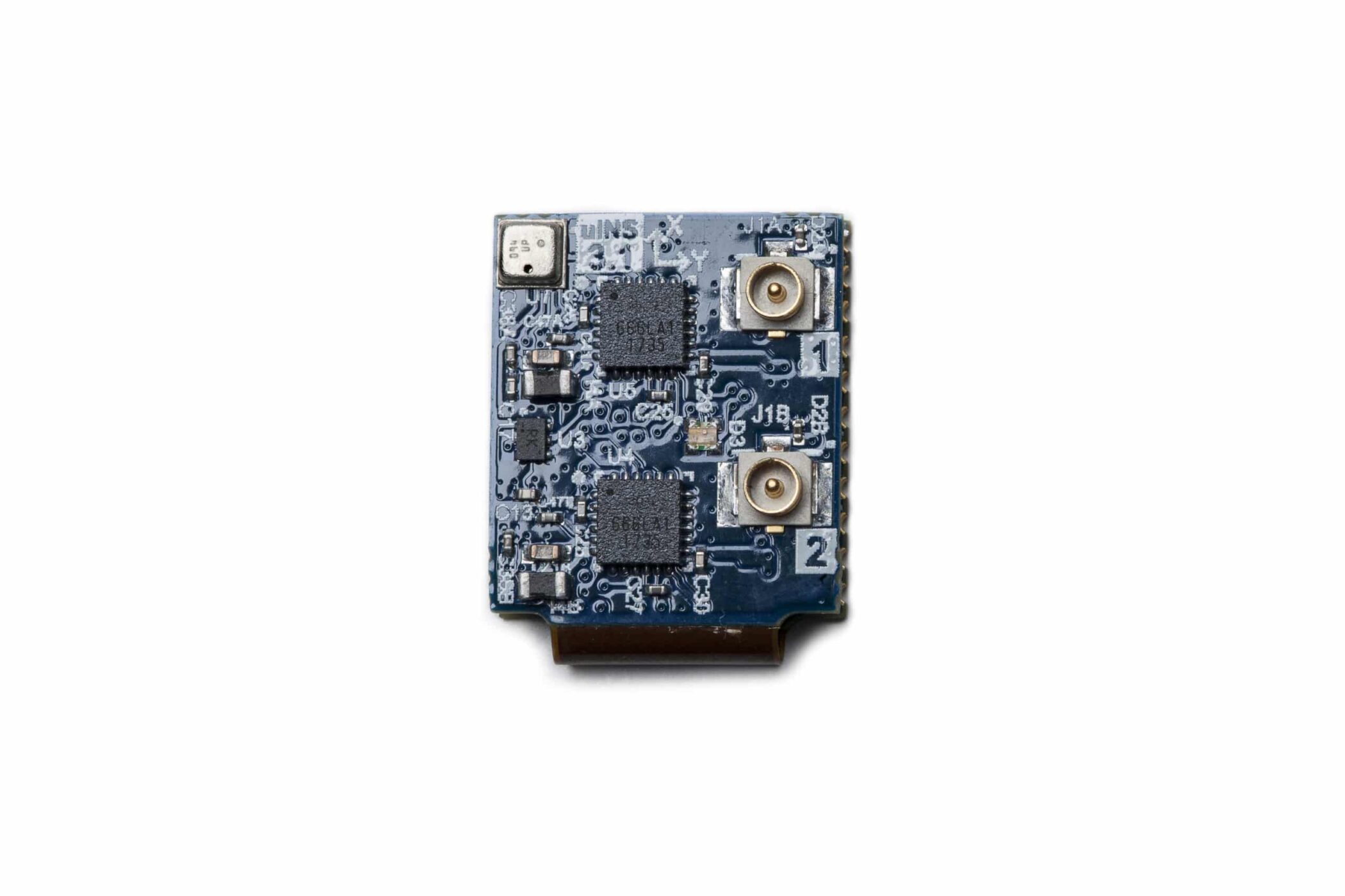
Inertial Sense offers µIMU, µAHRS, µINS, or dual antenna µINS products that provide all the performance of the more expensive units at a much lower price point. INS is used in a variety of applications including UAV navigation, automated vehicles, payload orientation, robotics, personnel tracking, and much more.
Result
Ceres Imaging is able to process a flight and quickly relay image results to farmers
With Inertial Sense calibrated, micro inertial navigation systems with sensor fusion onboard, Ceres can obtain accurate position and orientation information of a camera with respect to the ground. Also because of the harsh conditions Ceres overcomes using the µINS from Inertial Sense, it is safe to say that Inertial Sense provides all the performance of the more expensive units at a much more reasonable price point.
With better automation and a dedicated Inertial Sense support team, Ceres saves a lot of time, allowing them to process a flight and quickly relay image results to farmers. Ceres then gives the customers the information they need to respond to changes in their fields, helping them achieve higher quantity and quality of harvested goods.